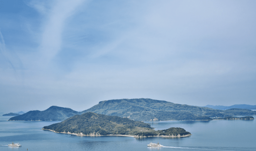

During a reconnaissance tour of Shōdoshima Island in Japan, I studied the coastline, the island’s offshore islands, and its tidal flows while walking, cycling, or taking a public bus.
My plan for Swim Shōdoshima (スイム小豆島)is to swim 75.8 km over 8 days in the counterclockwise direction in June 2026. It will be the final training and logistical preparation for the 1,188 km Swim Shikoku (スイム四国) that will start a month later 2026.
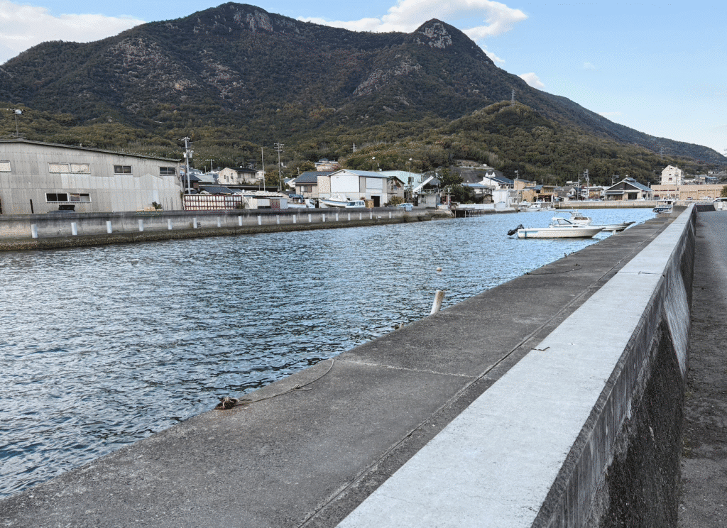
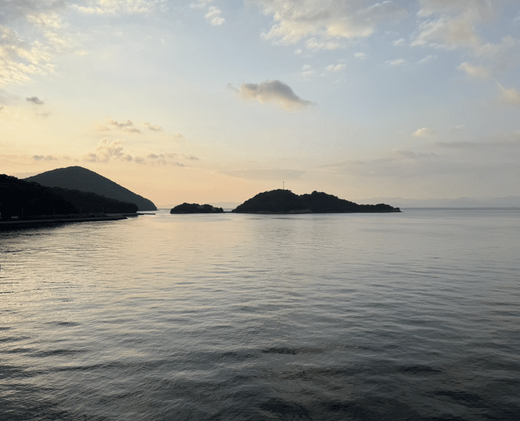
On two separate occasions during this reconnaissance, I crossed a narrow canal in different locations while walking on a sidewalk. With only 13,000 people on the island (far below its peak population of 33,380 due to a rapidly aging population), the entire island is tranquil and quaint with stunning landscapes and scenic coastal views of the Seto Inland Sea within hours of Kobe and Osaka by ferry.
But on the last day, I crossed the canal once again while on a public bus. As the bus driver stopped at a traffic light before crossing a bridge, he said, “This is the Dofuchi Strait, the world’s most narrow strait, acknowledged by Guinness World Records.”
As I looked out the window, straining to find this strait, I immediately thought to myself, “What strait? Where is it?”
I could not see any strait so I asked an older woman sitting near me in the bus. She replied, “We just passed it. It is behind us.”
Hmmm, now I was really confused. As an open water swimmer, I had to find out more about this strait. I exited the bus on the next stop and walked a few blocks where the bus driver had made that incomprehensible announcement.
Lo and behold, I came across this sign.
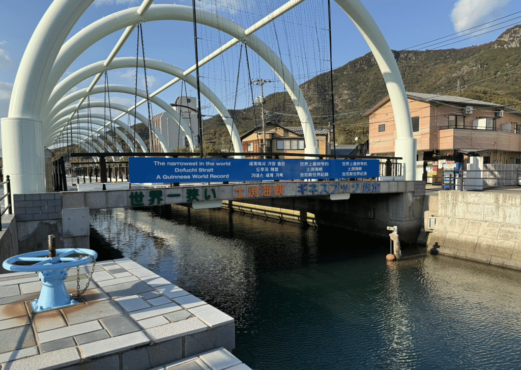
Whoa. That is cool. So what I thought was a narrow canal was actually a strait. How could that be?
I went to a local store and asked more about this strait. “Yes, this is Maejima. That (pointing across the street) is Shōdoshima.”
Whoa. Now that was really cool.
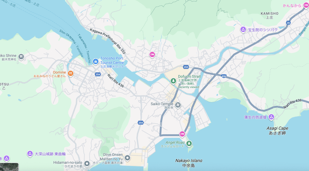
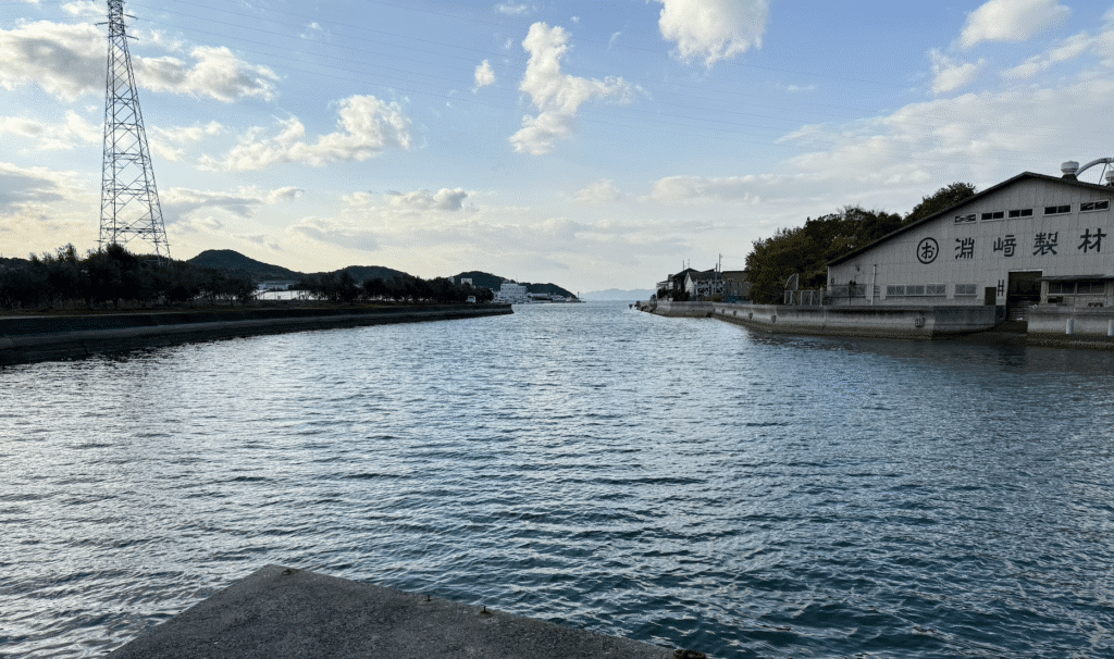
I did a quick search on Google Earth and learned the Dofuchi Strait is 2.5 kilometers in length, with a maximum width of 400 meters and a depth between 1.5 meters and 3.4 meters depending on the tide. Several bridges cross it. With a well-kept sidewalk and retail stores on each side and sandwiched between concrete embankments on both sides with several bridges for pedestrians and carscrossing it, there are no rugged shorelines that swimmers – or anyone – a hint that it is a natural strait.
So what I thought was one bigger island was actually two islands, separated by 9.4 meters at its closest point.
My original plan was to swim 6-8 days around Shōdoshima, but this idea of a circumnavigation swim was actually a swim around two islands: Shōdoshima and Maejima.
Which, of course, led to the natural question:
Could I plan on a figure 8 course and do two complete and separate – but continuous – circumnavigation swims?
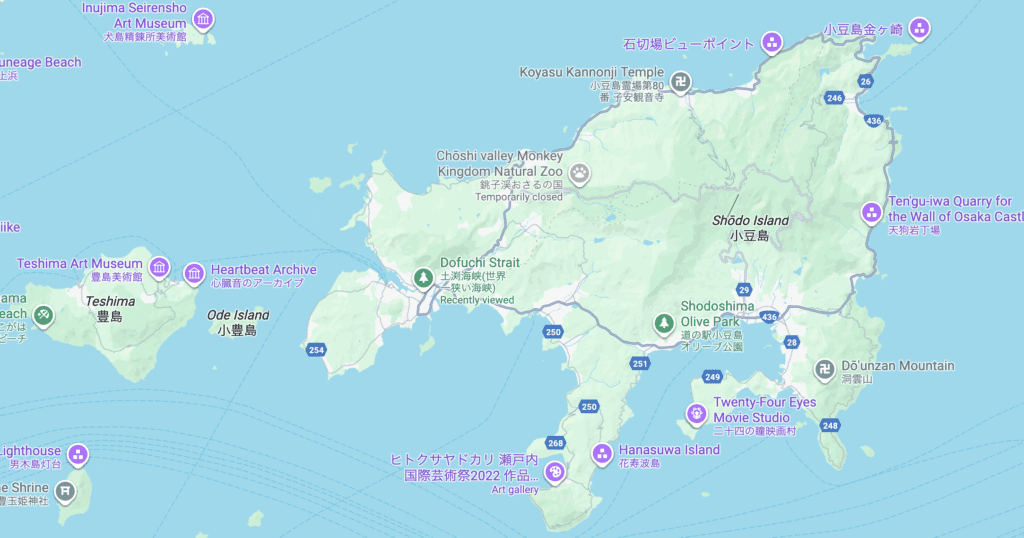
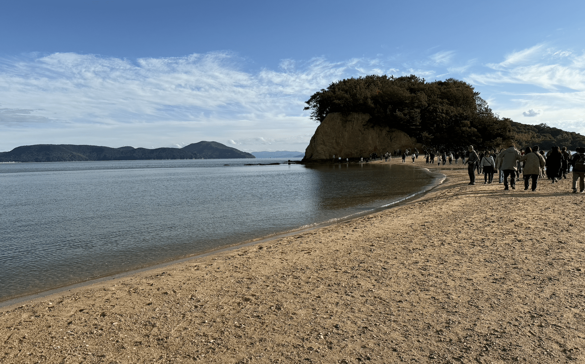
That is, I want to start on the Angel Road sandbar, a narrow strip of sand only appears at low tide between Shōdoshima and Nakayo Island. After the start at low tide from Angel Road, I would then swim in the counterclockwise direction around Shōdoshima, finishing back at Angel Road.
After circumnavigation swim #1 is successfully completed, then I can walk across Angel Road and carry on in the clockwise direction around Maejima. Swim around Maejima and swim through the narrow Dofuchi Strait again, and finish circumnavigation swim #2 once more on Angel Road.
Not only would that be cool, but as I am swimming around each island, I can also take numerous short detours and swim from the mainland of both Shōdoshima and Maejima to several uninhabited islands located close to both islands. That is, I can pioneer two circumnavigation swims – and potentially 17 short inter-island crossings en route, all under 1.6 km in distance.
© 2025 Daily News of Open Water Swimming
“to educate, enthuse, and entertain all those who venture past the shore“
World Open Water Swimming Federation, a human-powered project.